
«الأرصاد»: أمطار رعدية متفاوتة الغزارة على معظم مناطق المملكة – أخبار السعودية
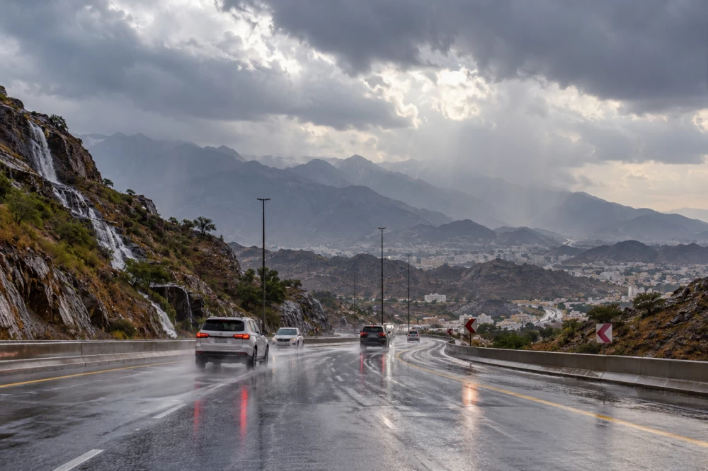
توقّع المركز الوطني للأرصاد في تقريره عن حالة الطقس اليوم (الأربعاء)، استمرار هطول أمطار رعدية متوسطة إلى غزيرة على أجزاء من مناطق جازان وعسير والباحة ومكة المكرمة، قد تؤدي إلى جريان السيول، وتكون مصحوبة بزخات من البرد ورياح نشطة مثيرة للأتربة والغبار.
وأوضح المركز أن الفرصة لا تزال مهيأة لهطول أمطار خفيفة إلى متوسطة على أجزاء من مناطق المدينة المنورة وحائل وتبوك والجوف والحدود الشمالية والمنطقة الشرقية والرياض.
ضباب على سواحل المملكة
وأشار التقرير إلى استمرار فرص تكوّن الضباب خلال ساعات الليل والصباح الباكر على الأجزاء الساحلية من شرق المملكة وغربها، ما قد يؤثر في مدى الرؤية الأفقية على بعض الطرق والمناطق الساحلية.
رياح تتجاوز 60 كيلومتراً في البحر الأحمر
وفيما يتعلق بحالة البحر الأحمر، توقّع المركز أن تكون الرياح السطحية شمالية غربية إلى جنوبية غربية بسرعة تتراوح بين 15 و30 كيلومتراً في الساعة على الجزء الشمالي، وبين 10 و25 كيلومتراً في الساعة على الجزء الأوسط، مع ارتفاع سرعتها إلى أكثر من 60 كيلومتراً في الساعة عند تكوّن السحب الرعدية الممطرة.
أما على الجزء الجنوبي، فتكون الرياح جنوبية شرقية إلى جنوبية غربية بسرعة تتراوح بين 10 و25 كيلومتراً في الساعة، وتصل إلى أكثر من 60 كيلومتراً في الساعة مع السحب الرعدية.
ويتراوح ارتفاع الموج بين نصف متر ومتر على الجزء الشمالي، فيما قد يتجاوز مترين على الجزأين الأوسط والجنوبي مع تكوّن السحب الرعدية الممطرة.
وتكون حالة البحر خفيفة الموج على الجزء الشمالي، وخفيفة الموج إلى مائجة على الجزأين الأوسط والجنوبي أثناء نشاط السحب الرعدية.
اضطراب متوقع في مياه الخليج العربي
وفي الخليج العربي، توقّع المركز أن تكون الرياح السطحية شمالية غربية إلى شمالية شرقية على الجزء الشمالي، وشمالية شرقية إلى شمالية غربية على الجزء الجنوبي، بسرعة تتراوح بين 10 و25 كيلومتراً في الساعة، وقد تتجاوز 60 كيلومتراً في الساعة مع تكوّن السحب الرعدية الممطرة.
وأشار التقرير إلى أن ارتفاع الموج سيتراوح بين نصف متر ومتر، وقد يتجاوز مترين عند نشاط السحب الرعدية، فيما تكون حالة البحر خفيفة الموج وتصل إلى مائجة مع هطول الأمطار الرعدية.
ويأتي ذلك في ظل استمرار التقلبات الجوية على عدد من مناطق المملكة، مع توقعات بهطول أمطار متفاوتة الغزارة ونشاط الرياح المثيرة للأتربة والغبار.
The National Center of Meteorology expected in its weather report today (Wednesday) that moderate to heavy thunderstorms will continue to fall on parts of the regions of Jazan, Asir, Al-Baha, and Makkah, which may lead to the flow of torrents, accompanied by hail showers and active winds stirring up dust and sand.
The center clarified that the opportunity remains available for light to moderate rain in parts of the regions of Madinah, Hail, Tabuk, Al-Jawf, the Northern Borders, the Eastern Province, and Riyadh.
Fog on the Coasts of the Kingdom
The report indicated that the chances of fog formation will continue during the night and early morning hours on the coastal areas of the eastern and western parts of the Kingdom, which may affect horizontal visibility on some roads and coastal areas.
Winds Exceeding 60 Kilometers in the Red Sea
Regarding the condition of the Red Sea, the center predicted that the surface winds will be northwesterly to southwesterly at speeds ranging between 15 and 30 kilometers per hour in the northern part, and between 10 and 25 kilometers per hour in the central part, with speeds increasing to more than 60 kilometers per hour when thunderstorm clouds form.
In the southern part, the winds will be southeasterly to southwesterly at speeds ranging between 10 and 25 kilometers per hour, reaching over 60 kilometers per hour with thunderstorm clouds.
Wave heights will range between half a meter and one meter in the northern part, while they may exceed two meters in the central and southern parts with the formation of thunderstorm clouds.
The sea condition will be slight in the northern part, and slight to moderate in the central and southern parts during the activity of thunderstorm clouds.
Expected Turbulence in the Arabian Gulf Waters
In the Arabian Gulf, the center predicted that the surface winds will be northwesterly to northeasterly in the northern part, and northeasterly to northwesterly in the southern part, at speeds ranging between 10 and 25 kilometers per hour, and may exceed 60 kilometers per hour with the formation of thunderstorm clouds.
The report indicated that wave heights will range between half a meter and one meter, and may exceed two meters during the activity of thunderstorm clouds, while the sea condition will be slight and may become moderate with the occurrence of thunderstorm rain.
This comes amid ongoing weather fluctuations in several regions of the Kingdom, with expectations of varying intensities of rainfall and active winds stirring up dust and sand.
للمزيد من المقالات
اضغط هنا
التعليقات